Large subdivision projects require accurate land data at the earliest stage of planning. Survey information supports approvals, engineering design, servicing strategies, construction layout, and legal registration.
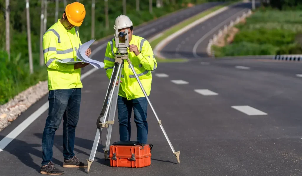
Modern land surveying combines advanced technology with field expertise to produce reliable site data at scale.
As a land surveyor serving Kingston and Sudbury, Avant Garde Geomatics uses GNSS receivers, RTK GPS, robotic total stations, drone mapping, and LiDAR scanning to capture precise measurements across large and complex parcels.
Here are 7 surveys required during different stages of a large subdivision project:
1. Boundary Survey
Large subdivision projects often involve land assembly, where multiple parcels combine into one development site. This process can expose discrepancies between historical records and site conditions. As your surveyor, we verify property corners, identify encroachments, and support the resolution of boundary conflicts before they affect planning, approvals, or construction.
2. Topographic Survey
Elevation changes, drainage routes, tree cover, rock outcrops, and existing site features all influence how the project moves forward. Weak topographic data can affect grading strategy, servicing design, and stormwater planning long before construction starts. We collect detailed surface information across large sites using tools such as drone mapping, LiDAR, and RTK GPS, then deliver data that supports confident engineering decisions.
3. Draft Plan of Subdivision
Lot fabric, road alignments, easements, blocks, and servicing corridors all depend on survey accuracy. At this stage, even minor inconsistencies can slow approvals or trigger revisions across multiple consultant teams. We support this phase by providing precise survey control and dependable base data that helps planners, engineers, and developers move through the review process with fewer complications.
4. Construction Layout Survey
Road alignments, curbs, utilities, catch basins, and lot limits all need exact placement before crews begin work. Our team uses robotic total stations and other high-accuracy equipment to mark critical points clearly, reduce rework, and keep field execution aligned with approved drawings.
5. As Built Survey
By the time infrastructure is in place, the focus shifts from intent to verification. Municipal reviewers, engineers, and developers need accurate records of what was actually built. Road elevations, utility placement, and final site conditions must align with approval requirements and design tolerances.
6. Reference Plan
Reference plans are required to document lots, blocks, easements, and other interests for registration. In a large subdivision project, this work must align with approved plans, legal descriptions, and final site conditions. Errors at this stage can affect registration, transfers, financing, and future development activity.
7. Supporting Surveys
Large subdivision projects often require additional survey support beyond boundary, topographic, and layout work. Utility surveys help confirm existing infrastructure before servicing begins. Control surveys maintain consistency across large sites and multiple construction phases. Tree, environmental, or hydrographic surveys may also be required depending on site conditions and approval requirements. Our team will discuss this at the beginning of the program.
For Your Commercial Land Surveying Projects
Avant Garde Geomatics is led by Juzer Noman, a licensed Ontario Land Surveyor with advanced training in geomatics. Juzer approaches surveying with a clear focus on accuracy, data quality, and modern geospatial methods.
Clients benefit from leadership that understands both the science behind surveying and the practical experience in the commercial space.
Reach out today to schedule a free consultation and start your project with confidence.